Tag: Enterprise Drones
Showing all 12 results
-
Read more
The DJI D-RTK 2 Mobile Station is a professional GNSS base station designed to deliver centimeter-level positioning accuracy for enterprise drones. Ideal for surveying, mapping, and industrial applications, it enhances flight precision and data reliability.
-
Read more
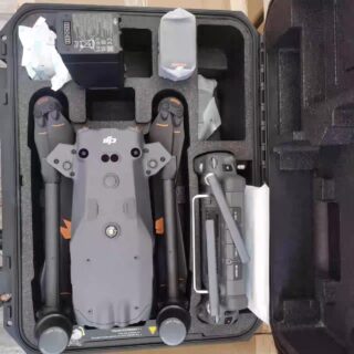
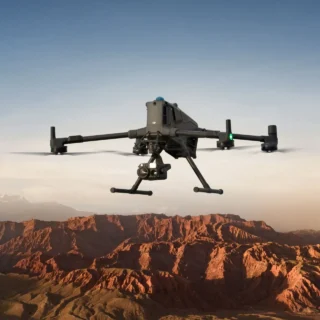
The DJI Matrice 30T is a rugged, high-performance drone that integrates wide-angle, zoom, and thermal cameras, plus a laser rangefinder. With up to 41 minutes of flight time, omnidirectional sensing, and IP-55 weather resistance, it’s ideal for inspections, emergency response, and advanced surveillance.
-
-
-
Read more
The DJI Matrice 400 is a powerful enterprise drone engineered for demanding industrial missions. With enhanced payload capacity, extended flight endurance, multi-sensor compatibility, and next-generation obstacle sensing, it delivers unmatched performance for inspection, mapping, public safety, and environmental operations.
-
Read more
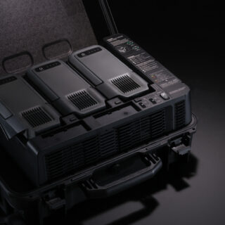
The smart battery station offers a comprehensive all-in-one solution for charging, storing, and transporting batteries.
-
Read more
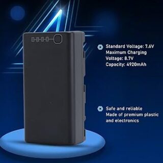
This 2S 4920mAh battery offers outstanding discharge performance in cold conditions and charges rapidly.
-
Read more
Facilitating extended-duration aerial lighting and communication base station operations through cable connections.
-
Read more
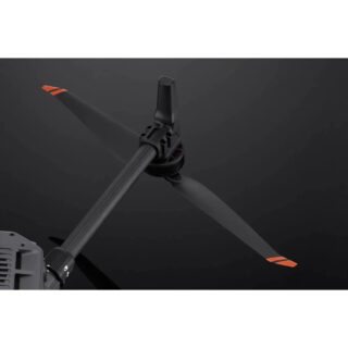
The DJI Matrice 4E is a versatile drone built for accurate mapping, surveying, and industrial inspections. It features RTK positioning, flexible payload support, and long flight time for reliable aerial operations.
-
Read more
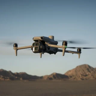
The DJI Mavic 3T is a high-performance enterprise drone built for thermal imaging, precision inspections, public safety, and rapid response operations. Featuring a 48MP visual camera, 640×512 thermal sensor, long flight time, and advanced obstacle avoidance, it delivers unmatched efficiency for mission-critical workflows.
-
Read more
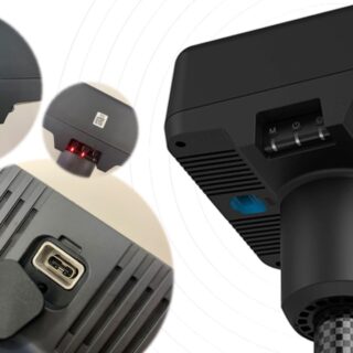
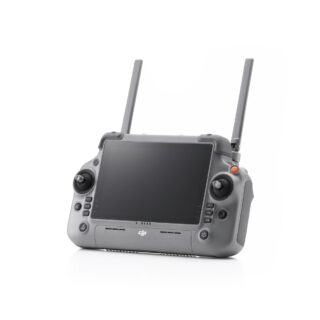
The DJI RC Plus 2 Enterprise is a rugged, high-performance remote controller designed for professional drone operations. With an intuitive touchscreen, long-range connectivity, and enterprise-grade features, it enhances control, efficiency, and mission safety.
-
Read more
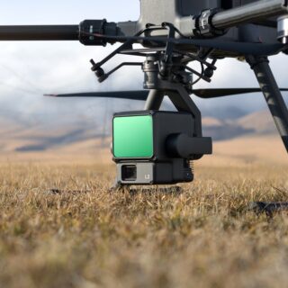
The Zenmuse L2 is an integrated LiDAR payload combining a high-accuracy laser scanner, a precision IMU, and a 20 MP 4/3-inch RGB camera. Built for professional surveying and 3D mapping, it delivers dense point clouds, multi-return capability, and reliable geospatial accuracy.